Southern Italy 3D Wine Map
Campania, Puglia, Basilicata, Calabria, Sicily, and the volcanic islands in full 3D terrain.
Southern Italy is where ancient grape varieties meet some of the most dramatic terrain in the Mediterranean. From the volcanic soils of Campania and Mount Etna to the plains of Puglia, from the highlands of Basilicata to the wind-swept island of Pantelleria, the geography is as diverse as anywhere in the country. Indigenous varieties like Aglianico, Nero d’Avola, Nerello Mascalese, and Fiano are producing wines of real ambition and site-specificity. This map covers the DOC and DOCG zones of Southern Italy with detailed popup data. The bookmarks are the best way to navigate: use them to fly between Campania, Puglia, Sicily, and the islands.
Unlock the Full SommGeo Toolkit
Gain exclusive access to our entire suite of premium features, including interactive Map Makers, immersive 3D Tours, high-resolution classic Maps, and advanced analytical tools.
Start Free TrialWhat You’ll Explore
This 3D Fast Map covers the DOC and DOCG zones of Southern Italy, including the mainland regions, Sicily, and the smaller islands. Click any mapped appellation for detailed popup content covering grape varieties, classification details, and geographic specifics. Start with the bookmarks to fly between Campania, Puglia, Sicily, Etna, and the islands. Then use the layer controls to filter by regional grouping and manage the visual complexity.
- Southern Italy’s DOC and DOCG zones mapped with detailed popup data
- Bookmarks to fly directly between Campania, Puglia, Sicily, Etna, and the islands
- Elevation profile tool for measuring vineyard altitude and slope gradients
- Daylight and shadow animation to visualize aspect and sun exposure
Key Regions in Focus
Campania and Basilicata
Campania’s volcanic geography defines its wines. Taurasi, in the hills east of Avellino at 400 to 700 meters (1,310 to 2,300 feet), is the home of one of Italy’s most powerful and age-worthy reds, built on Aglianico grown in volcanic soils. The soils are volcanic (tufo, ash, pumice) over clay, and the altitude preserves acidity in this late-ripening grape. Fiano di Avellino and Greco di Tufo, from the same highlands, produce structured, mineral whites. Basilicata contributes Aglianico del Vulture, grown on the slopes of Monte Vulture at 200 to 800 meters (655 to 2,624 feet), producing a slightly different, often more approachable expression.
Sicily and Etna
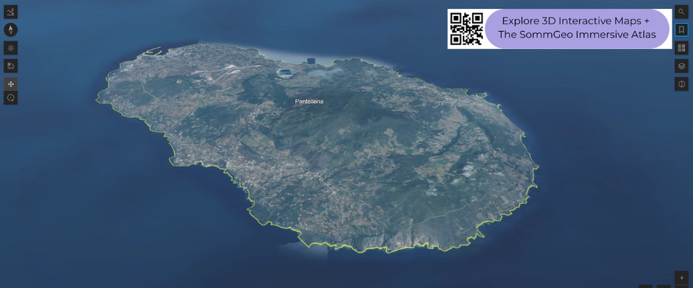
Sicily is Italy’s largest island and one of its most dynamic wine regions. Etna is the headline: Nerello Mascalese and Nerello Cappuccio grow around the volcano at 400 to 1,000 meters (1,310 to 3,280 feet) on lava, ash, and pumice, producing reds with transparency and structure that have drawn comparisons to Burgundy. Western Sicily around Marsala grows Grillo, Catarratto, and Nero d’Avola on limestone, while the southeast produces Cerasuolo di Vittoria (the island’s only DOCG) from Nero d’Avola and Frappato. Pantelleria, the volcanic island between Sicily and North Africa, produces its famous Passito from Zibibbo trained in the alberello pantesco system.
Puglia and Calabria
Puglia is one of Italy’s largest wine-producing regions by volume, with long, flat, sun-drenched plains ideal for high yields. But the quality story is about specific zones with more interesting geography. Salento in the far south grows Primitivo and Negroamaro on terra rossa over limestone, while Gioia del Colle on the elevated Murge plateau at 300 to 500 meters (985 to 1,640 feet) produces a more structured, fresher Primitivo with aging potential. Castel del Monte occupies limestone hillsides where Nero di Troia shows character. Calabria, at the toe, is small but notable for Cirò (Gaglioppo on the Ionian coast). The elevation profiles reveal how dramatically the landscape shifts from coastal plains to highland zones.
New to 3D Fast Maps? Learn how to navigate 3D terrain, use elevation profiles, animate sunlight, and get the most from your map.
3D Fast Maps Guide →Ready to explore Southern Italy’s wine regions in full 3D? Join 200+ wine organizations already using SommGeo.
Start Your 15-Day Free Trial $5/month billed annually after trial · Cancel anytimeMap Usage & Permissions
Personal Use
You are welcome to use, download, and share the maps on this site for personal, educational, and non-commercial purposes. If you share a map, please credit SommGeo with a link back to sommgeo.com.
Commercial Use
Use of these maps for any commercial purpose, including websites, print publications, marketing materials, or any other commercial venture, is strictly prohibited without prior written permission.
To inquire about custom SommGeo platforms, maps, or commercial licensing, please contact greg@sommgeo.com.

