
Interactive Wine Maps & Tools
One platform. Six tools. Every major wine region.
SommGeo is a complete GIS-powered atlas of the wine world, built from the ground up for wine professionals and advanced students. Interactive 3D terrain, searchable appellation data, custom map building, and guided vineyard tours, all held to the same depth of reference-grade content.
Google Earth for the Wine World
A toolkit built for the full scope of a wine professional’s work. The six SommGeo tools are not a collection of related features assembled over time. They are a purpose-built set, designed around what working sommeliers, advanced students, and beverage professionals actually reach for across the arc of their careers.
Built on Real GIS Data
Every boundary, elevation line, and appellation polygon comes from authoritative geographic sources. Not illustrations, not approximations. Real cartography layered with content written to the level the industry’s highest certifications demand.
Purpose-Built as a Toolkit
Six tools designed around what a wine professional actually reaches for across the job: geographic reference, study-grade depth, print-ready cartography, and daily operational math. Not a collection of features assembled over time. A purpose-built toolkit for the whole scope of the work.
Reference-Grade at Every Layer
Whether you’re glancing at a Fast Map at the table or studying a Tour ahead of a Master Sommelier exam, the content depth matches the moment. Every region is treated as the subject of serious study, to the reference-grade depth the highest certifications demand.
Six Tools, Each With a Purpose
Every tool in SommGeo is built for a specific way of working with wine geography. Here is what each one does, who it is for, and how it differs from the others.
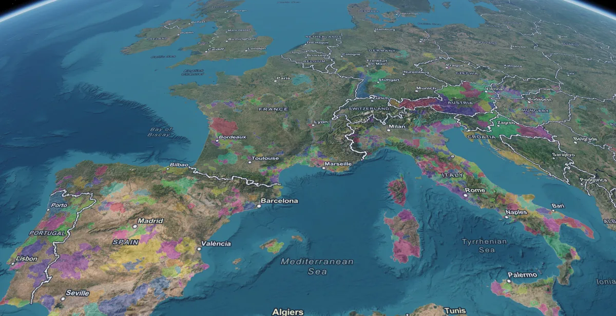
SommGeo Globe
- Every major wine region on one surface
- Search appellations from the 3D view
- Zoom from continent to individual vineyard blocks
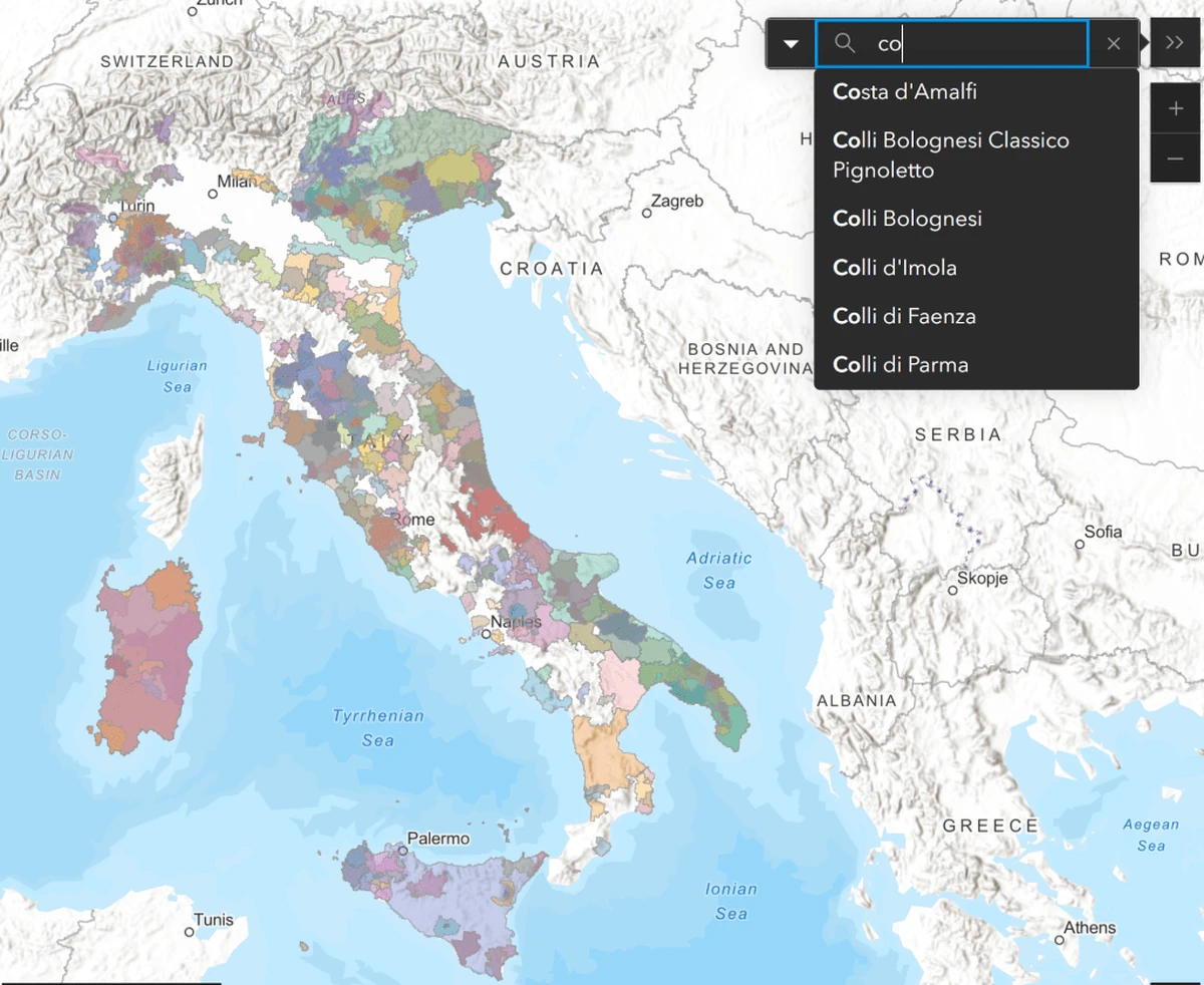
Fast Maps
- Every appellation, fully searchable
- Mobile-optimized for the service floor
- 22+ countries across 15 Fast Maps
- Includes 3D Fast Maps with terrain and sun-aspect analysis

Map Makers
- Full layer, label, and basemap control
- 2D and 3D satellite views with elevation profiles
- Built for study decks, presentations, and more
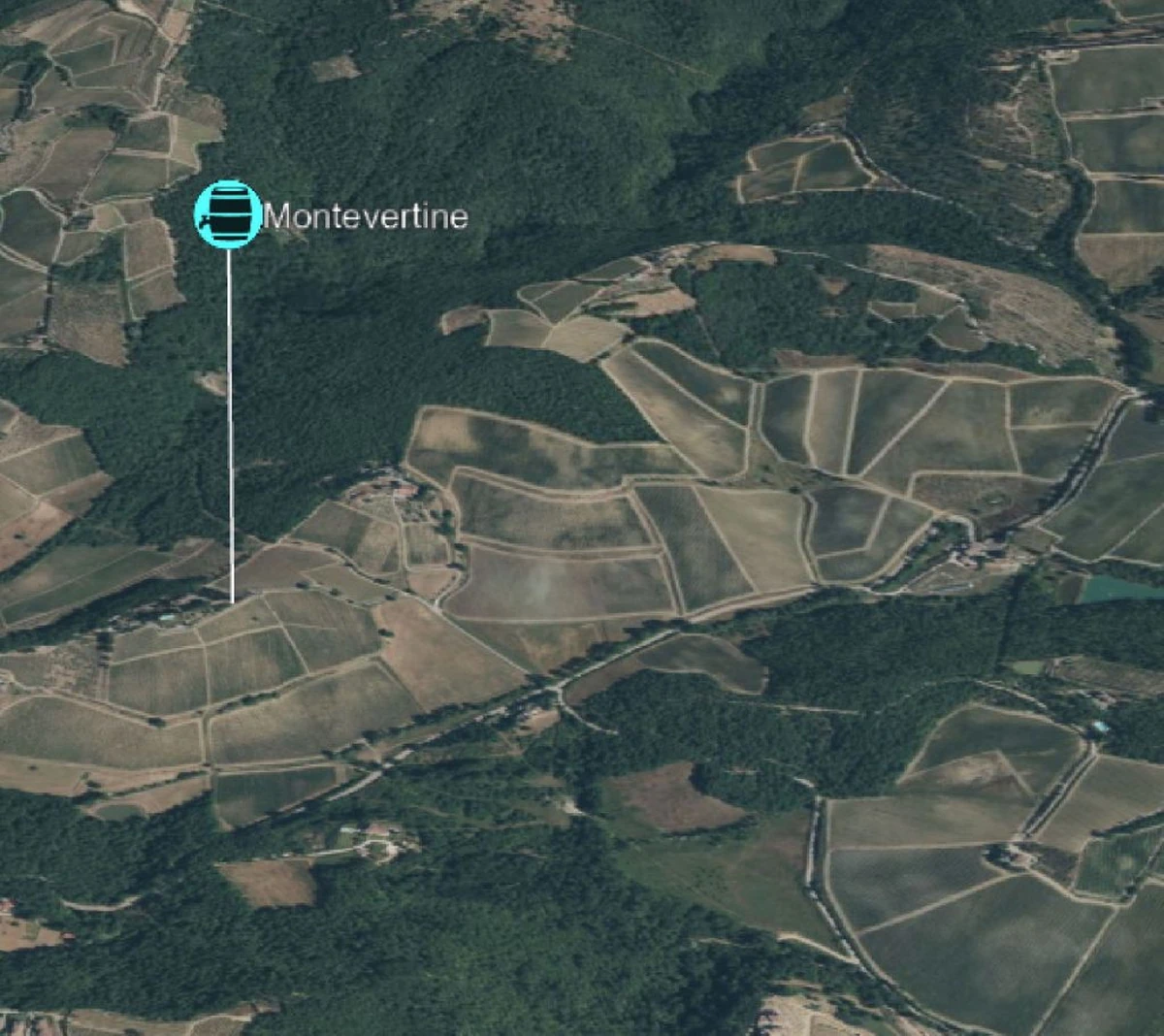
Tours
- Actual elevation data, not illustrations
- Reference-grade content at every waypoint
- 24 Tours across the world’s major regions
- Producer, classification, and context at every stop
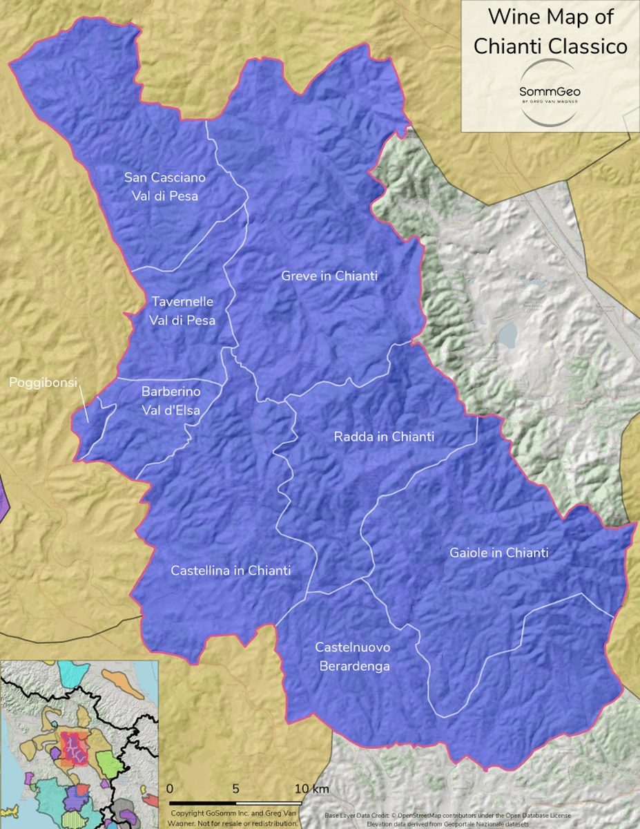
Classic Maps
- High-resolution exports
- Professional cartographic labeling
- Built for study binders, tasting kits, and reference
Tools
- Pour cost and pricing calculators
- Profitability and target margin models
- Unit conversions across beverage formats
Custom Platforms for Regions, Producers, and Trade Organizations
Wineries, importers, distributors, regional associations, and promotional bodies commission custom SommGeo platforms to showcase their terroir and educate their trade. Your appellations, your producers, your narrative, delivered in the same immersive format as the public atlas. The tools that sommeliers already trust, branded and built for your program.
The Whole Atlas, Reference-Grade.
Start a free trial to unlock every tool, every region, every layer. Or explore the free demos first to see the platform before you subscribe.