
SommGeo Classic Wine Maps
GIS cartography for the wine world.
High-resolution wine maps built with the same geospatial precision behind the rest of the SommGeo platform. Designed for study, print, and professional reference. Every boundary placed from source data, not traced from textbooks.
Professional Cartography, Built from GIS Data
Classic Maps are SommGeo’s traditional cartographic output: clean, high-resolution wine region maps built using the same geographic information system that powers the interactive tools. Every boundary is sourced from official geospatial datasets. Every label is placed with the precision and legibility that professional reference demands. These are not illustrations redrawn from an atlas. They are the atlas.
The Layers Behind the Surface
Appellation boundaries come from official registries. Terrain comes from digital elevation models. Rivers and streams trace real hydrological networks. Where cadastral records exist, individual parcels are placed from survey data. What you see is the finished surface of those layers, stacked and balanced.
Print-Ready Resolution
Designed with clear labeling hierarchies and carefully balanced color palettes that hold up at any scale. Whether you are printing a study reference for your desk or projecting a region overview for a classroom, the detail remains sharp and legible.
Part of the Whole Platform
Classic Maps complement SommGeo’s interactive tools. Use a Fast Map to search an appellation in seconds. Open a Map Maker to isolate the layers you need. Then reference the Classic Map for a clean, static overview of the complete picture. Different formats for different moments.
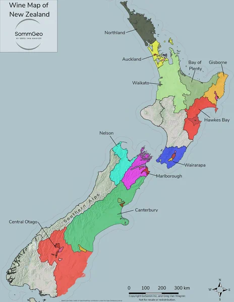
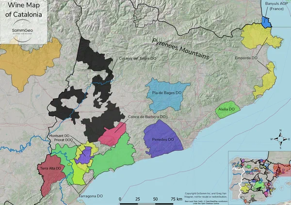
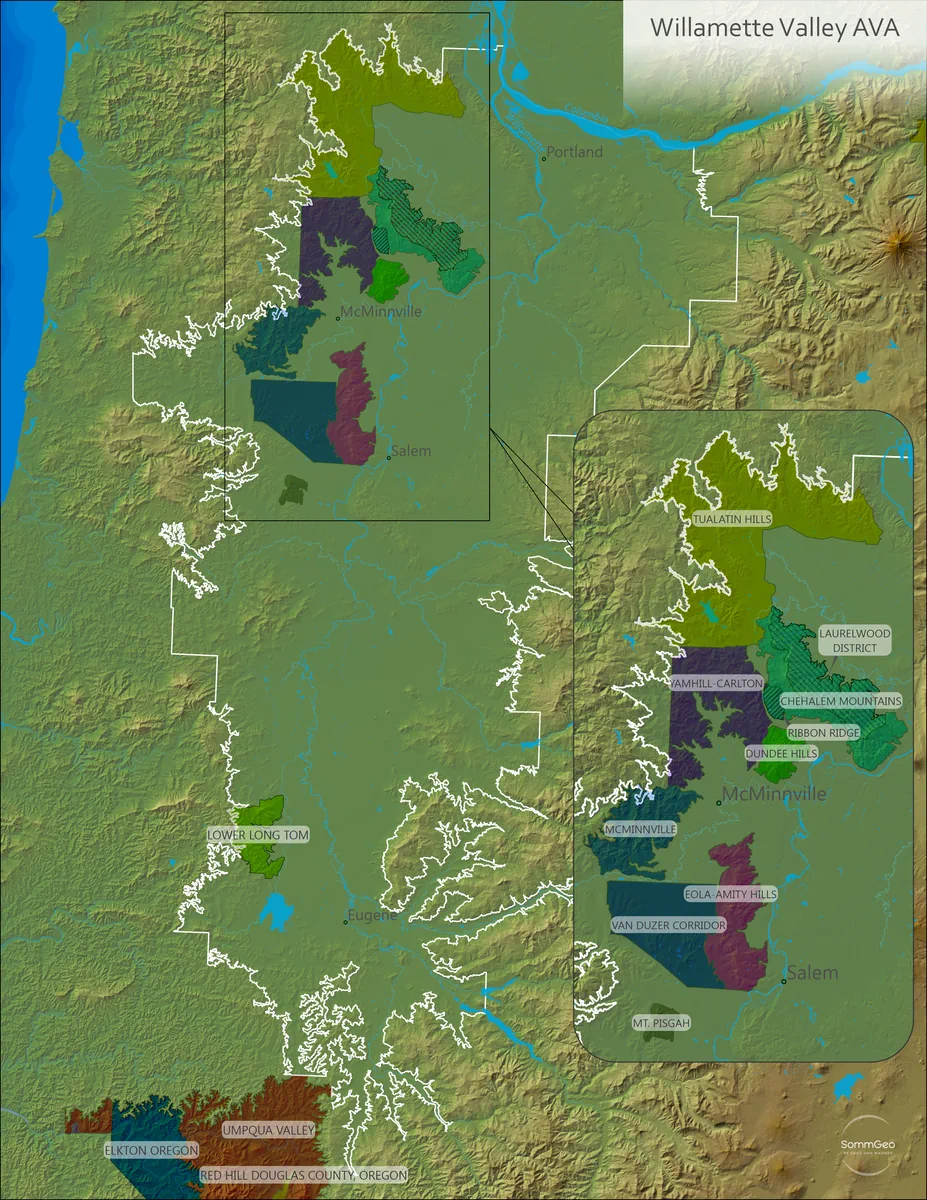
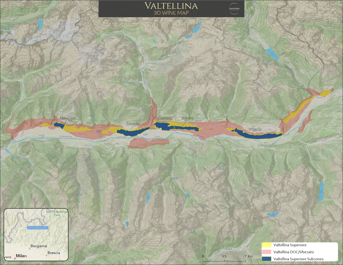
10 Countries. Dozens of Regional Maps.
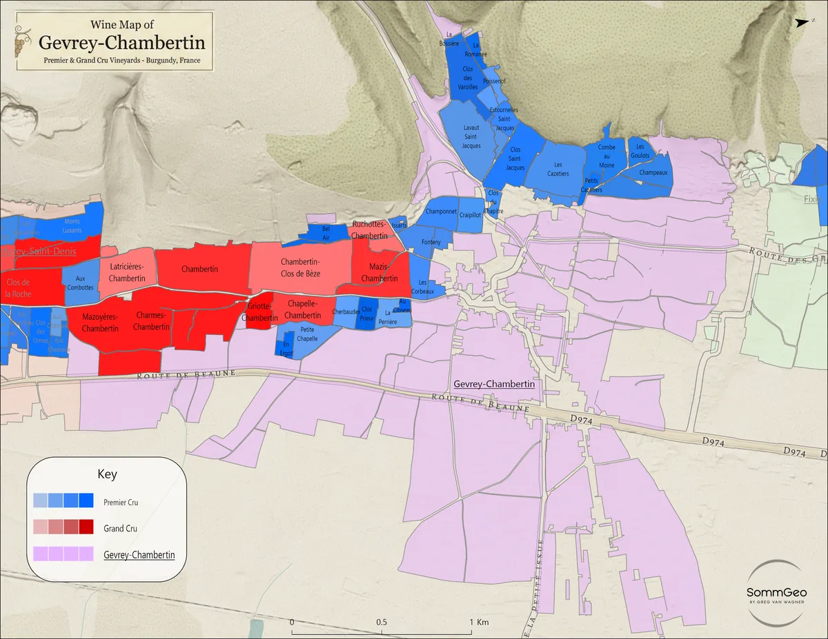
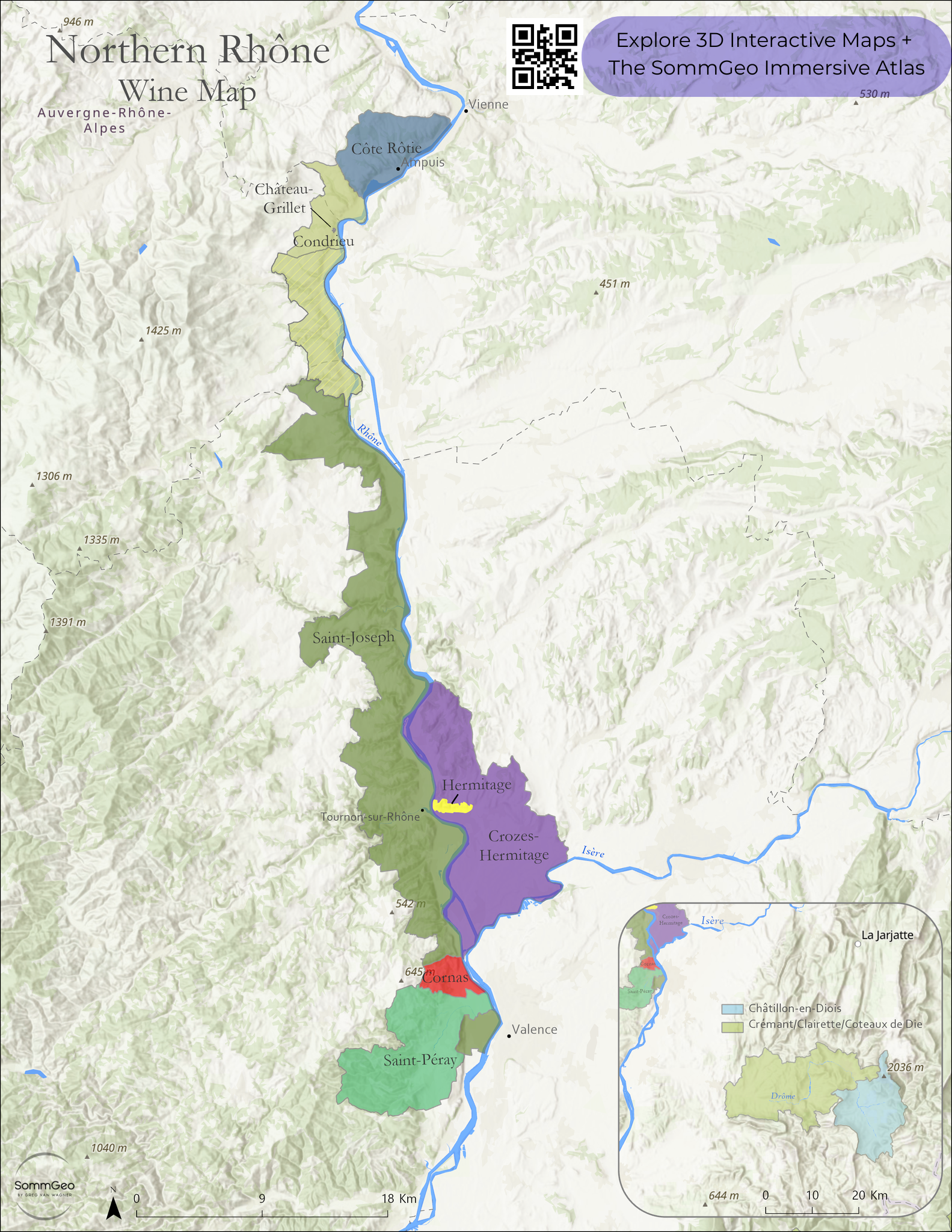
Each country page opens a curated gallery of Classic Maps covering that nation’s wine regions. From the Cote de Nuits at the vineyard level to the broad strokes of New Zealand’s North and South Islands, every map is built from GIS source data with consistent cartographic standards.


Complimentary Wine Maps
Six Classic Maps available to everyone, no login required. Each one is built in the updated cartographic style that will roll out across the full Classic Maps library over the coming months. Open one, zoom in, and see where the collection is headed.


Where a Static Map Still Wins
The foundation is the same GIS data behind the rest of the platform. The distinction is purpose. Classic Maps are built for the moments an interactive tool cannot serve: a printed reference on the wall, a slide in a deck, a handout passed around a tasting room.
The Static Reference You Still Need
Interactive tools are powerful for active study. But there are moments when you need a clean, fixed overview: pinned above your desk, printed for a blind tasting group, or projected behind a lecture. Classic Maps fill that role with cartographic clarity that interactive views are not designed to provide.
- Clean labeling hierarchies that hold up at print resolution
- Consistent color palettes across all countries for visual continuity
- Boundary accuracy sourced from official geospatial data
- Pairs with Fast Maps and Map Makers for a complete study workflow
The Map Your Presentation Needs
Walk into a staff training with a map that was built to professional cartographic standards, not pulled from a Google image search. Show a regional overview that is accurate, legible, and reflects the quality of your program.
- High resolution output suitable for projection and handouts
- Complete regional coverage from national overview to commune detail
- Consistent visual language across all mapped countries
- A professional reference you can stand behind
Custom Cartography for the Wine Trade
SommGeo produces wall-scale professional wine maps, custom regional cartography for marketing collateral, and branded map packages for trade associations, importers, and producers. Your regions, your data, rendered to a standard that print pieces and PDFs were never built to match.

Open One. See the Detail.
Open any of the six complimentary maps to see the precision and detail firsthand. When you’re ready for the full collection, a SommGeo subscription unlocks everything.
The Rest of the Platform
Classic Maps are one layer of the atlas. Here’s what else is inside.
The Globe
Every wine region on Earth, one searchable 3D globe.
LaunchFast Maps
A flat, searchable atlas of every appellation in every country.
Browse AtlasMap Makers
Build custom maps with toggleable layers and terrain views.
Open Map MakersTours
Immersive 3D flyovers with reference-grade regional detail.
Take a TourTools
Pour cost, pricing, flight profitability, and conversion calculators.
Open Tools